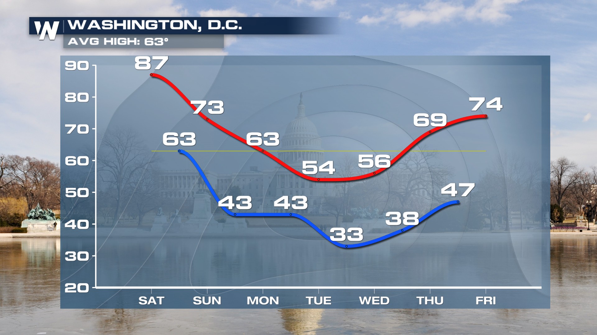
Cold Front Ends Record Heat

Unseasonably warm air is taking over much of the eastern United States this holiday weekend, bringing a taste of summer well ahead of schedule. Temperatures are soaring 15 to 25 degrees above average from the Southeast through the Mid-Atlantic and into parts of the Northeast, with many cities climbing into the upper 80s. Record highs did fall on Saturday.
This early-season heat is not just about warm afternoons, it is also setting the stage for active weather. As the atmosphere becomes more unstable, the risk for thunderstorms increases. Some of these storms could turn strong to severe, producing gusty winds and heavy downpours as the warm, humid air fuels their development.
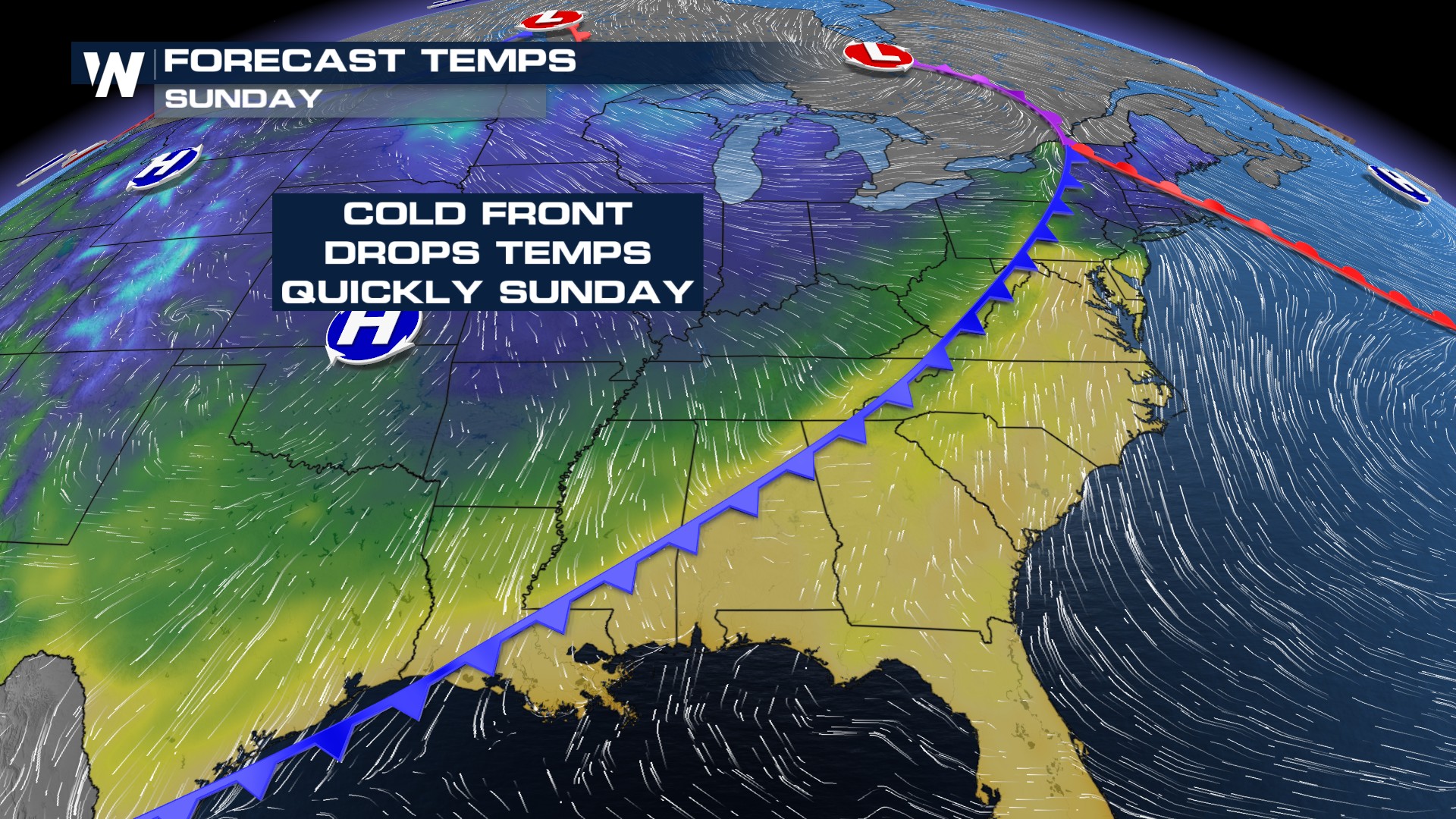 But the summer-like stretch will not last long. A cold front is sweeping across the eastern half of the country, bringing rounds of rain and thunderstorms along the East Coast. Behind it, a much cooler air mass will move in, quickly knocking temperatures back down into the 40s and 50s this weekend before slowly creeping up next week.
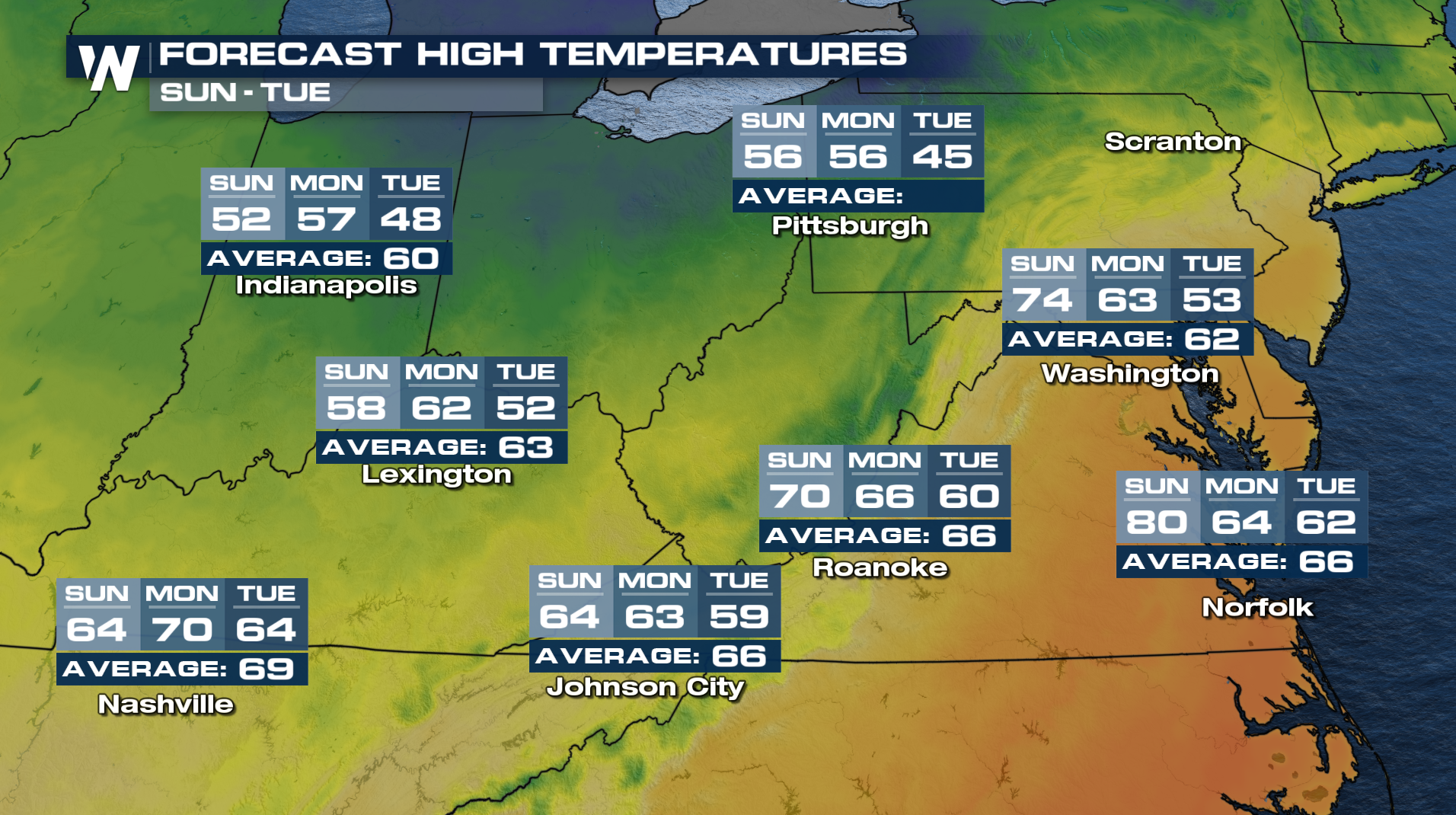
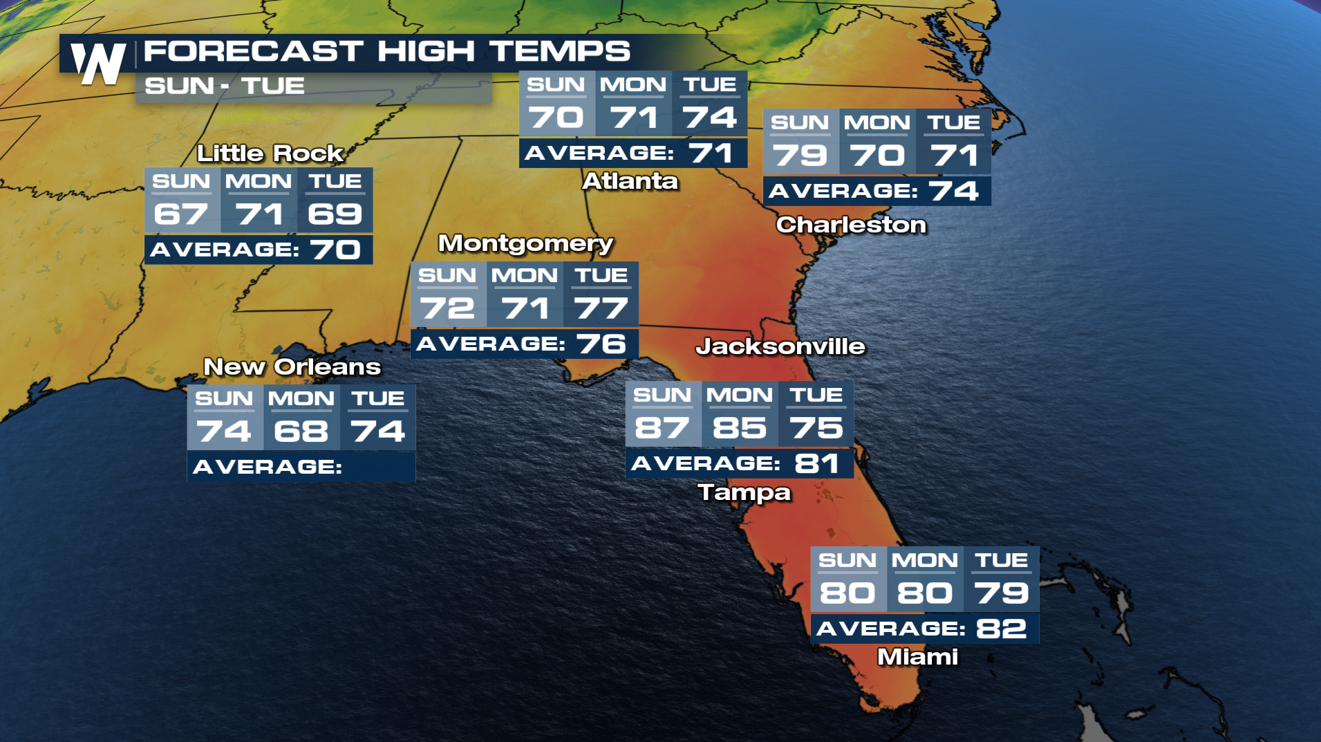
By the start of the new week, the same areas that experienced near-record warmth will feel a much different air mass. Highs across parts of the Northeast are expected to drop into the 50s, marking a sharp return to more typical early spring conditions. The rapid shift from warmth to chill is a classic example of springtime “weather whiplash,” where dramatic temperature swings can happen in just a matter of days.